…and ping the site. You will earn 10 points in the challenge. Enter a comment to earn additional points, up to another 10 points. A one word comment like “cool”, “inspirational”, or “memorable” with gain you an additional point. If your comment is personal, and heart wrenching like:
“My grandmother said this was much different then. There were no trees and the sun was hot and we washed our clothes over the side of the boat.” OR
“I saw three small foxes cavorting at the edge of the towpath under the watchful mother’s eye” OR
“Beautiful sunset, all deep red that faded into purple as twilight fell and the birds quieted.”
…would earn you up to ten additional points. You can visit the Byway more than once during the challenge period, but each time visit a different location or locations. The extra points will be judged by an independent panel and results and winners announced by June 15. There will be prizes: first place with the most points will get $250; second place a $50 gift certificate for Stewart’s Shops; third place a $25 gift certificate.
Visit one site or experience the whole Byway. Visit yourself or include the whole family or a car load of our friends. Just do it before November 15 on the Mohawk Towpath Byway.
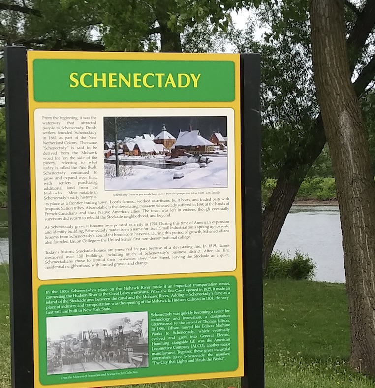
This year we celebrate the 200th anniversary of the opening of the Erie Canal. The Mohawk Towpath Scenic Byway parallels the Mohawk River and the Erie Canal between Waterford, Cohoes, and Schenectady. One of the strongest intrinsic values of our Byway is history. This provided an ideal opportunity to publicize the Byway and its connection to the waterway west.
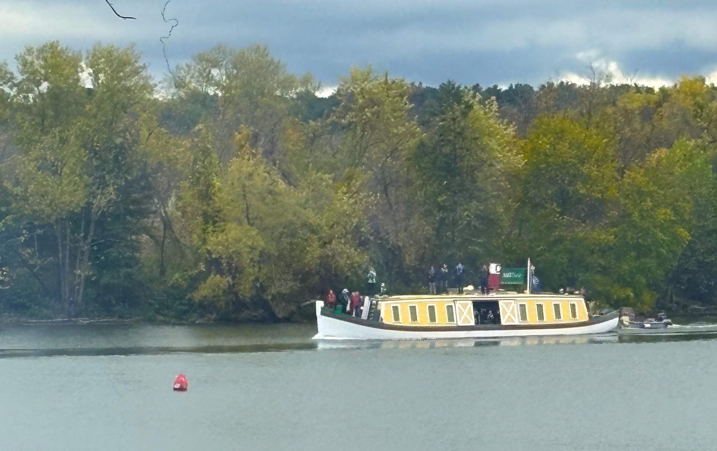
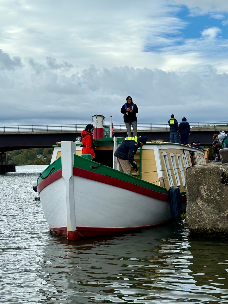
Although the communities have been drumming the beat of the anniversary all year, the actual opening of the canal from Albany to Buffalo occurred in late October 1825. Major commemorative celebrations started with the construction of a replica of the Seneca Chief at the Buffalo Maritime Center several years ago. During the World Canal Conference held the last week in September the Seneca Chief, in a grand celebration left Buffalo Harbor for a re-enacted journey across the Erie Canal to New York City. Stopping at major historic canal ports along the way, the crew collected samples of water to pour in New York harbor like Governor Clinton did 200 years ago. On its journey to New York City the packet boat stopped at Schenectady on October 14 to provide tours to the public and educational field trip opportunities for local school children, bringing history to life.
Seneca Chief passes Ferry Drive in Clifton Park. – Photos by Eric Hamilton
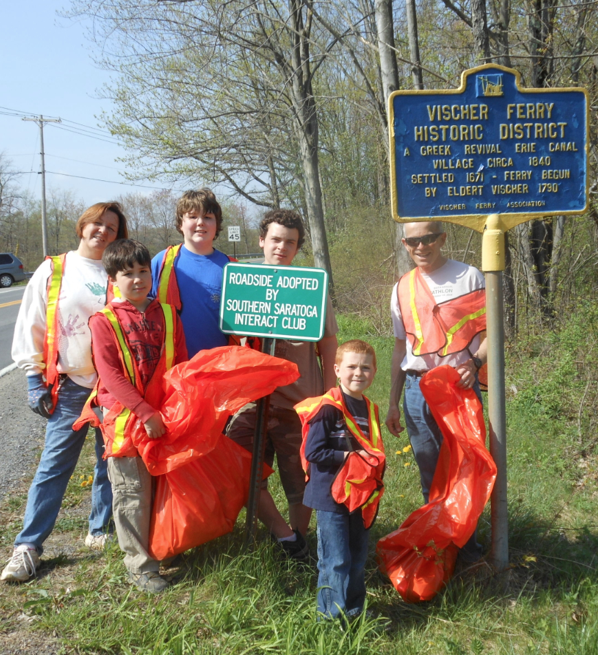
Meanwhile, the Town of Clifton Park held a well attended Canal Festival in the hamlet of Vischer Ferry on the weekend of October 11 and 12. The weekend included a dedication of historic marker, a parade, food vending, military re-enactors, historically popular youth games, historic trade demonstrations, working canal lock model, tours of historic structures, hay rides to a historic lock, antique car show, folks songs on the Canal, a presentation by local historic artist Len Tantillo, and a stage performance of historic narrative and song The Remarkable, Irresistible Erie directed by Andy Spence.
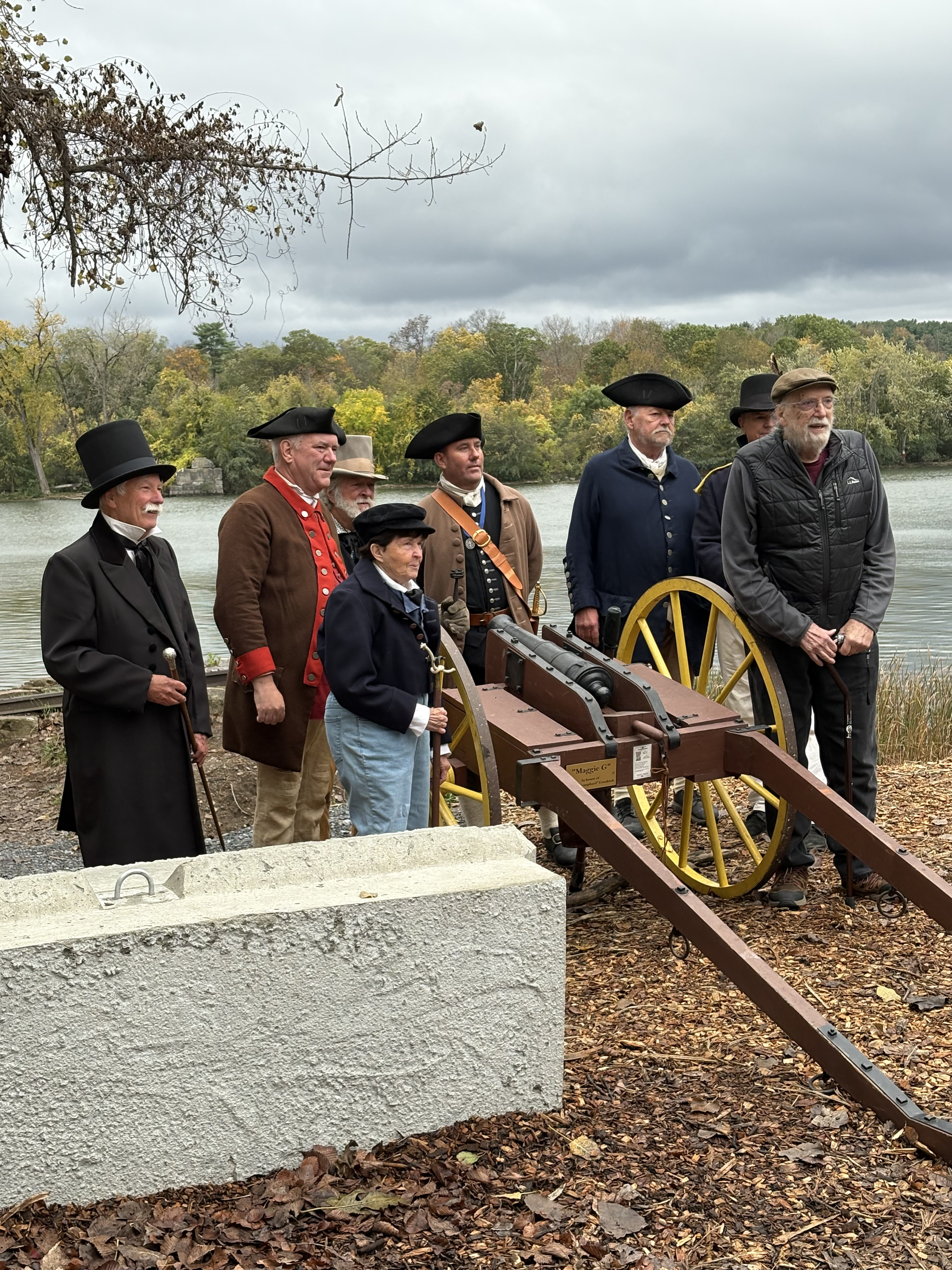
History records that cannons were fired along the canal to signal the approach of the Seneca Chief 200 years ago and was an important way of telegraphing the opening of the original Erie Canal before the telegraph, telephone, or internet. Following suit this fall, anyone who owns a canon or has access to a historic military device put it to a constructive use! Locally a group of re-enactors of the Albany Militia gathered to fire their canon as the Seneca Chief approached Ferry Drive in Clifton Park.
The Town of Halfmoon provided Live music, picnic fair, and ceremony by noted dignitaries as the boat tied up at Terminal Road dock so the crew had a pitstop before descending the flight of the locks into Waterford Harbor. Here too, a canon was fired as the Seneca Chief moved on toward the Flight of Locks on Waterford.
The boat spent the day tied up at Waterford Harbor providing tours to the public and several large groups of school children from various Capital District schools. The crew provided educators that did an impressive job with program geared to grade school youth as they toured the interior of the Seneca Chief, planted a pine tree and explaining the perspective of indigenous people as the Erie Canal cut through native lands.
This series of events underscored the historic intrinsic value of the Mohawk Towpath Byway in a very real, tangible way where any number of lectures could never achieve. This history lesson conveyed to school children, to families, and older adults could not have been better or more appropriately conveyed.
Thank you to all of the town historians; local, regional, and state officials; along with all our volunteers for their cooperation in highlighting this milestone on the Erie Canal now as we reshape the canal’s purpose from a commercial asset that built the Empire State to a recreation asset we all can enjoy whether from shore or from the perspective on the water.
Everyone knows the benefits of exercise even a short walk on a regular basis. Here’s a walk in the middle of the Mohawk Towpath Byway corridor that is level and accessible even for those in a wheelchair, and it reveals two centuries of canal history; at least two wildlife habitats; and much more!
Unfold two centuries of canal history, two wildlife habitats, and much more on the half mile walk.
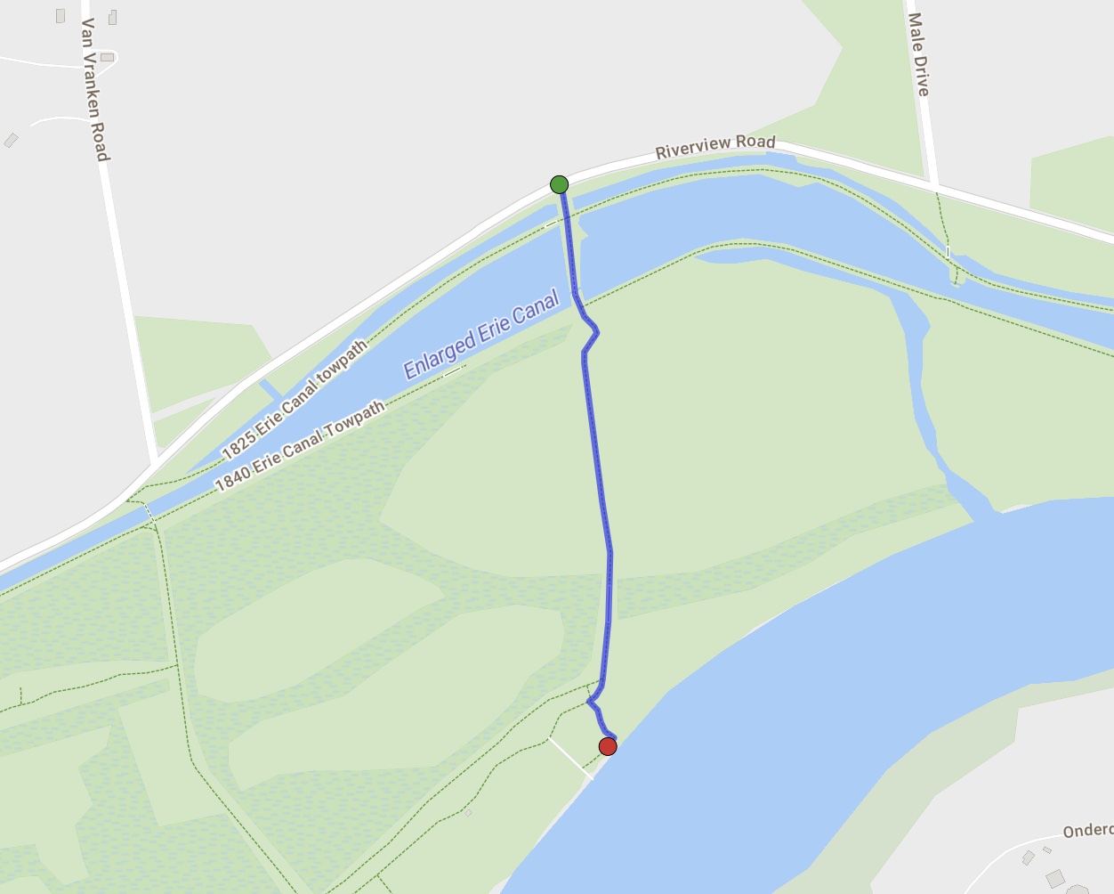
Carefully park at the entrance to the Water Authority access road on Riverview Road half way between Male Drive and VanVranken Road. I use the adjective “carefully”, because you don’t want to block access to Clifton Park’s water supply infrastructure. If there are more than three cars there come back another day or later is the day!
As you walk south the first body of water on your left is the original Erie Canal and the trail to the right is the towpath for that 1825 “Clinton’s Ditch”. This is one of the few places in the state where you can see the original canal still watered.
Walk further and you pass over the 1842 enlarged Erie Canal. This was the Erie Canal, the waterway west until 1917 when the Canal was moved to the current mainstream of the Mohawk River. The towpath for this Canal was washed out with a spring flood sometime in the late 1980’s. Would it be difficult to replace this towpath with a boardwalk? When the Towpath Community Connector Trail was constructed in 2015 the trail followed the route south, along the Water Authority access road you are on today.
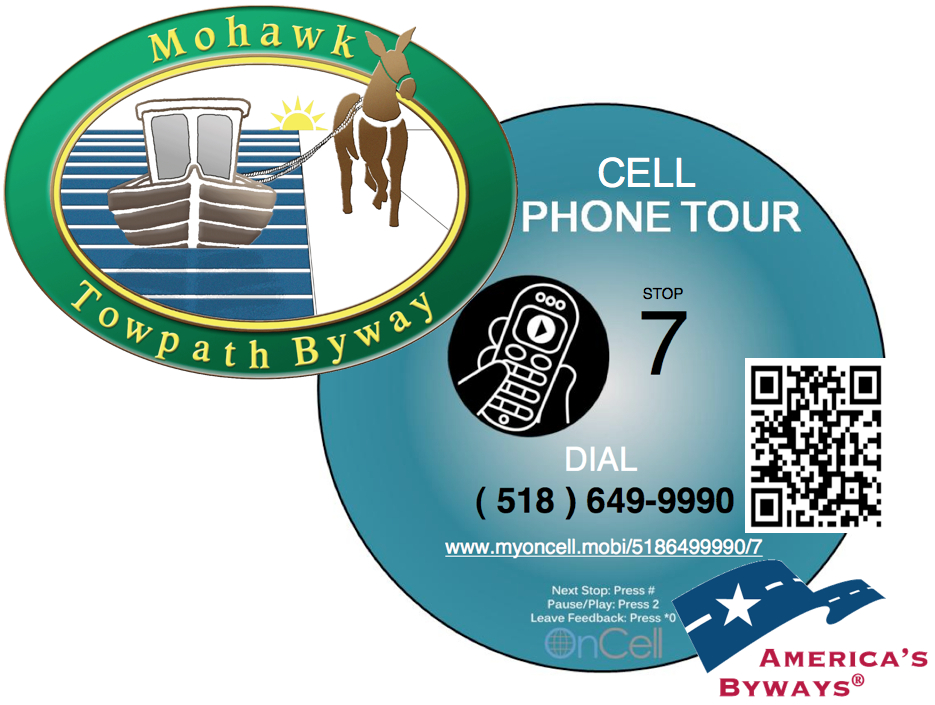
As you continue south you will pass Stop 34 on the birding trail. Dial 518-649-9990 and key in 34 at the prompt. You will hear a narrative by an Audubon Society member describing the upland bird habitat.
Also note the green painted devises that anywhere else would be painted red as a fire hydrant. This is a part of the system that provides about six million gallons of water to the Town of Clifton Park and neighboring communities.
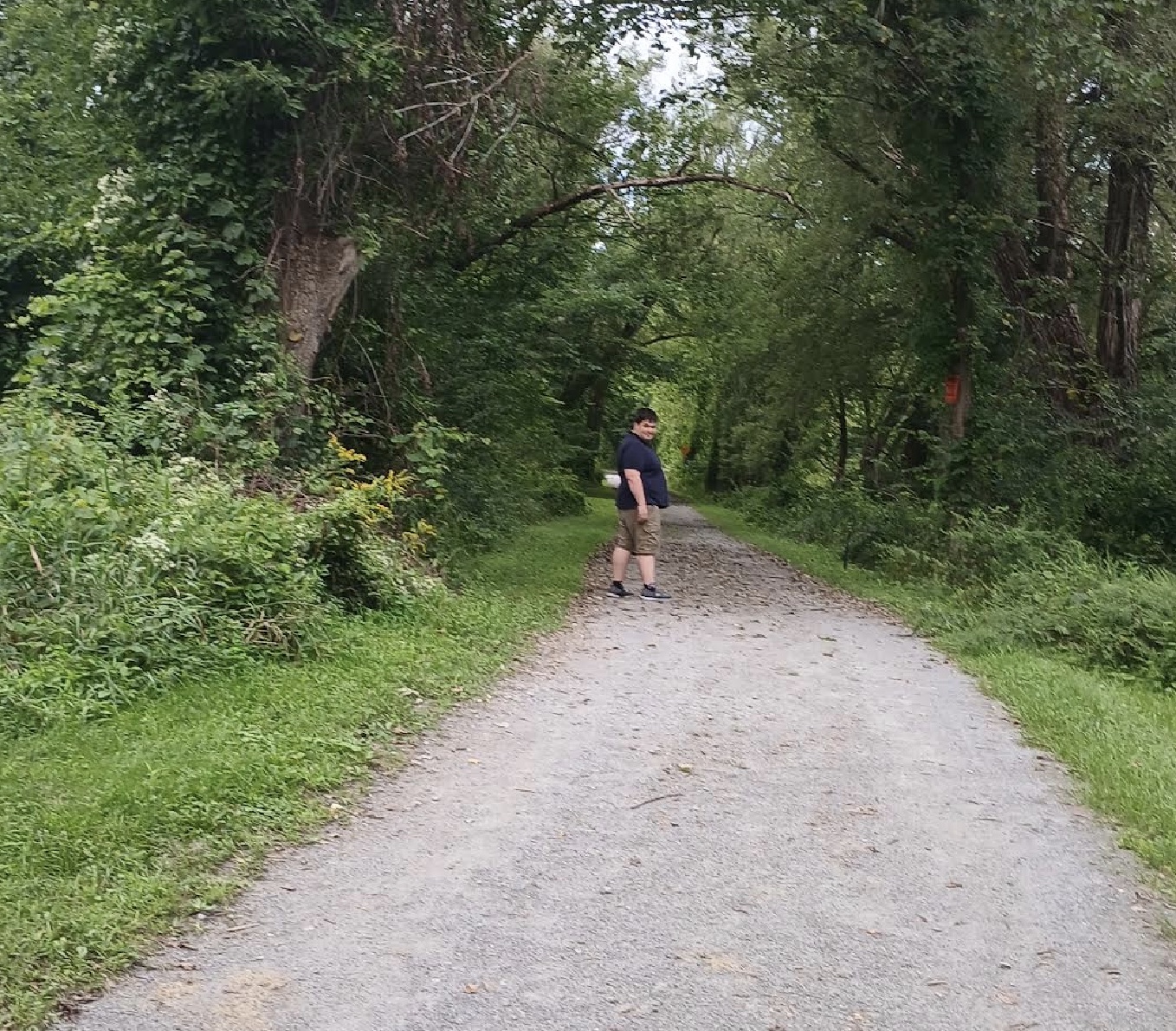
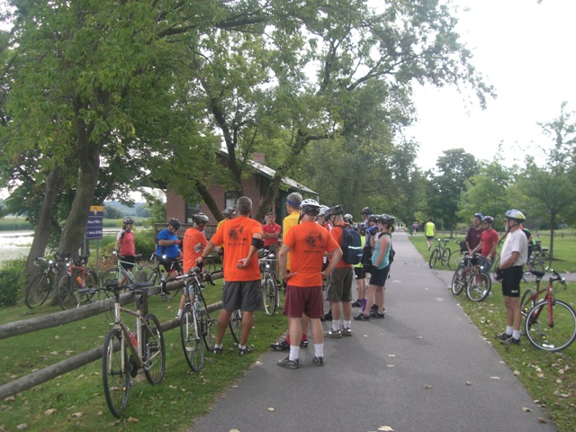
A segment of the Towpath Community Connector Trail.
At the point where the trail turns to the right (west) you will see a large picnic area maintained by volunteers from the Capitol Region Chamber in cooperation with the Town of Clifton Park. Enjoy this area for picnicking. Stop 33 on the birding trail, mentioned above, describes the waters edge habitat and some of the bird species that favor this area including bald eagles.
Complete your mile walk by retracing your steps back to Riverview Road. On the return look for other evidence of wildlife activity.
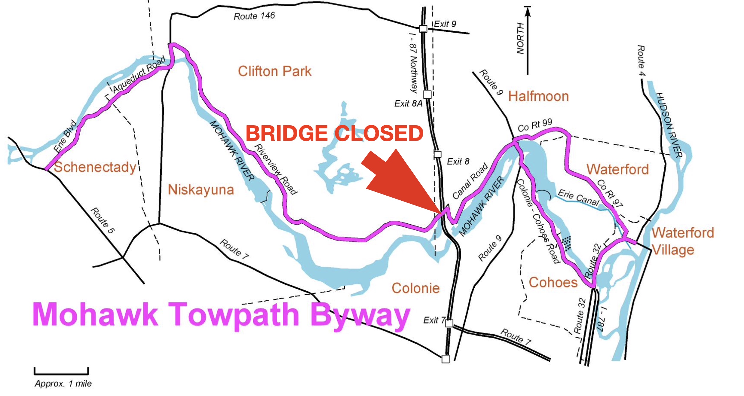
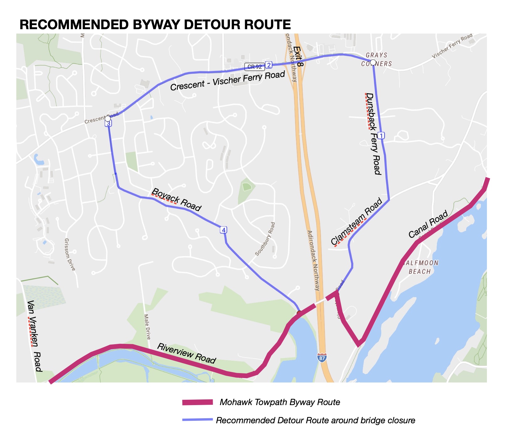
Riverview Road is closed at the bridge over I-87 Northway. Located in the Town of Halfmoon this is an important connector between the hamlets of Crescent and Vischer Ferry and the Vischer Ferry Nature and Historic Preserve on the Mohawk Towpath Byway.
What happened? A oversized vehicle southbound on I-87 Northway struck the bridge and “tore three [of the five] beams that support the bridge.” NYSDOT is trying to figure out how the bridge remains standing and if repairing the bridge is feasible or do they replace the bridge.
Location of the bridge that is out along the Mohawk Towpath Byway.
According to the NYSDOT website PIN172275 Riverview Road over I-87 in Halfmoon was expected to be substantially complete June 7, 2028.
How do we advise Byway visitors, as well as locals to detour:
West bound
continue northeast on Clamsteam Road 0.64 miles, and
Turn left on Dunsbach Ferry Road for 0.75 miles, and
Turn left on Crescent Vischer Ferry Road for another 1.57 miles, and
Turn left again onto Boyack Road and follow it south for 1.68 miles to Riverview Road.
East Bound
Carefully navigate around the barrier located at the Van Vranken and Riverview Road intersection.
Don’t forget to visit Clutes Dry Dock.
At the second barrier take a left onto Boyack Road. Go 1.68 miles and
Turn right onto Crescent Vischer Ferry Road for 1.57 miles, and
Turn right on Dunsbach Ferry Road and continue 0.75 miles, and
Turn right onto Clamsteam Road. In 0.64 miles you get to, yet another “Road Closed” barrier turn left and you are back on the designated Byway route.
The next meeting of the Friends of the Mohawk Towpath Scenic Byway will be Sept 12 at Schenectady Distilling Company, 3304 Amsterdam Road, Glenville. This will be a tasting open to the public. We supply the Erie Canal related presentation, drum up an attendance of forty people, and they will provide a tasting of their products.
This will be a pleasant, relaxed departure from our usual meetings which tend to be totally focused on the Byway; the Erie Canal; and the waterway west. I plan on bringing a power point type presentation (lots of images) of the “State of the Byway”.
This is a kick-off of our public availability sessions on the draft Corridor Management Plan (CMP). Sure it is a bit different than any other Byway has done it, but why not? The “State of the Byway” summarizes sections 1, 2, and 3 of the CMP. I will add a slide or two to show where the nearest Erie Canal features are to the Distillery (which features “36 Locks beverages”). Here’s an approximate schedule of what we have planned:
4 to 5 PM – Tour of the distillery and tasting
5 to 8 PM – hors d’oeuvres
6 to 7 PM – Byway Presentation, questions, discussion, answers
From a historic perspective alcohol played an important part in building the Erie Canal. Treated municipal water, that we take for granted, was not available. In the spirit of building public acceptance of our Byway plan, let’s relax and enjoy each other’s company as exhausted canal workers must have ended the day of moving mud and stumps to make way for what is now history?
Note that attendees are expected to make a $5 donation to the Byway on entry. Non-alcoholic beverages will be available for us tea-toddlers who are encouraged to provide car pool or rides for others!
(As published in the National Scenic Byway Foundation e-newsletter.)
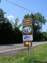
As an ambassador for our Byway, the most common and often used technique is my elevator speech. It takes about ten seconds to say, “The Mohawk Towpath Byway is a driving route between Waterford and Cohoes and Schenectady here in New York that follows the historic route of the Erie Canal and the waterway west.”
It is an attention grabber. The first few lines of our website, an introduction to an indoor lecture, outdoor wayside tour, or the first lines on a bus tour. It is much better than saying, “Test. Test. Is this mic on?”
What the visitor to your byway is going to remember is this personal contact and this first impression. Make it a good one. Smile, be sincere, enthuse with body language that adds to the feeling of authenticity. Be ready for the follow-up question like, “Is it a bike path?” Or “What’s the story here?” Or “Where’s the nearest public restroom?” Or “Do you have a map?”
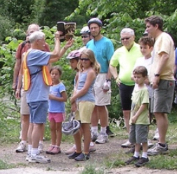
Tour host and historian John Scherer narrates a story on the Mohawk Towpath Byway. Note his leaning into the audience, gesture, and enthusiasm that all add to the authenticity of the story. [ Note that John is also holding the book he authored, Images of America: Clifton Park. Tell me that doesn’t add to the authenticity!]
What is your byway elevator speech? Can you say it in your sleep?
For help with your elevator speech visit Storytelling in Person, a factsheet in our NSBF Resource Library.
Our number one, top priority within the Mohawk Towpath National Scenic Byway corridor is to provide a positive visitor experience, period.
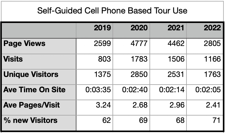
But how do we measure or quantify our successes? The designated route is along public roads that are open 24/7/365! Most of our historic features are along public highways or in, or along side the right-of-way. One such measure would be the number of hits on our website. That’s a start, but that’s only the visitors to our website. Intuitively visits to our website would reflect early curiosity or the number of people searching for a unique experience, not physical visits to the Byway. When we first set up the Byway’s website one of the concerns was that if we included too much information, too many pictures that would provide the whole experience and no one would try the real, authentic, visit.
I disagree. The more we can provide pictures of people enjoying the Byway and its many features the more we inspire the public to gain their own experience by physically visiting the Byway. My feeling is that use of our cell phone based self-guided tour is one of the best metrics of Byway visitation and experience.
Gathering information on visitors, not personal information, but number of calls to the self-guided tour are most helpful. Also the number of brochures that are picked up at various Byway locations are revealing.
Data provided by OnCell Systems, now STQRY.
The above data shows that visits almost doubled during the pandemic. People, including you and I, needed to get out of the house, but go where they were not exposed to others. A drive on the Mohawk Towpath Byway or visit one of our parks or historic sites was the perfect answer. Recent numbers are back, but not down to pre-COVID numbers. Perhaps return visits to the Byway and a greater digital marketing effort are definitely playing a role.
Also note that visitors don’t spend a lot of time on the page or listening to the entire narrative. If it is longer than 2 minutes they are gone to the next or are otherwise distracted.
For those of you who have used the self-guided tour service before, we will be adding new sites, new STOPs this spring along Erie Blvd. in Schenectady and in downtown Cohoes.
The year 2025 will mark the 200th Anniversary of the opening of the Erie Canal. Many events are being planned for 2025 between Albany and Buffalo and beyond to celebrate the canal’s completion. Declared the eighth Wonder of the World by many at the time, this gem sites in your very own back yard. But you don’t have to wait until 2025 to enjoy tours and shows.
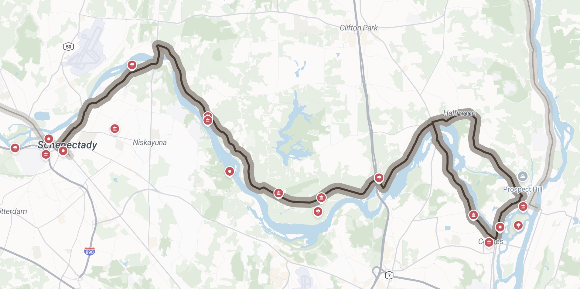
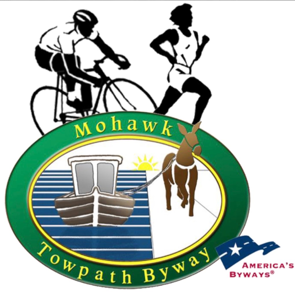
A free, self-guided tour already exists called the Mohawk Towpath Scenic Byway. The Byway is a federally recognized, 26 mile drive between Waterford and Schenectady showcasing sites and sounds and a wide variety of activities.
If you have never seen the 70 foot high Cohoes Falls, go look at it after a really good rain storm. Follow the Mohawk River down to the junction with the Hudson River in Waterford. There see the remains of the Champlain Canal which was completed in 1822, before the Erie Canal. Then check out the Waterford flight – five locks lifting the Barge Canal 169 feet in just 1 1/2 miles to circumvent the Cohoes Falls. Above the falls, head north to Crescent and cross the Mohawk River on the Route 9 bridge. At this very spot, the Erie Canal crossed the Mohawk River on a huge 1,137 foot long stone bridge with 26 spans—the longest aqueduct on the entire canal system. For the next 13 miles to the west, the Erie Canal hugs the Mohawk’s shore through southern Saratoga County. Here along the Byway you can discover a preserved lock, a Whipple Truss bridge, three ferry landings pre-dating the canal, a birding sanctuary and several nature preseryes, plus places to fish or launch canoes and kayaks. There are plenty of opportunities to park your car and walk miles of trails. Some are along the shore of the barge canal; some are, in fact, on the original towpaths of the Ditch and Enlarged Canal still filled with water. Drive through the village of Vischer Ferry with its beautifully maintained canal-era homes and quaint general store. Then cross back over the Mohawk River on Route 146 at the canal town of Rexford. The Rexford Bridge is in the same spot where a second stone aqueduct carried the Erie Canal back to the south side of the Mohawk. After crossing the bridge, from a park just east of the traffic circle, you can see a few remains of the 14 original stone spans of the 610 foot aqueduct. Following Aqueduct Road to the west will bring you to Erie Boulevard in downtown Schenectady. This wide road is actually the canal filled in and paved over.
Special road signs mark the entire Byway route; maps and information available at mohawktowpath.org show the more than 30 designated stops where you can listen to audio descriptions of the history that happened here.
What are you waiting for? Let’s celebrate the opening of the Erie Canal now!
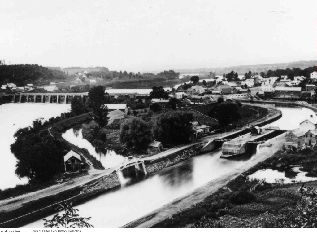
[This article by Nancy Papish first appeared in the ECOS Newsletter and is used here by permission. The Photograph is of lock 22 c. 1880 with Rexford in the background and the Upper Aqueduct across the Mohawk River to the left. Compare this photograph with the present day image used on the home page.]
The Friends of the Mohawk Towpath Scenic Byway proudly partner with Old Songs, Inc to bring this unique program to the Clifton Park Halfmoon Library on September 24 at 2 PM free admission. This 90-minute musical concert, telling stories of the people, the places, and the history of the original and enlarged Erie Canal, Presented in song with narration.
The Concert features songs by folklorist and historian George Ward, Canadian Joe Grant, Dan Berggren & Jean Ritchie along with other traditional Erie songs.
Musicians and singers: George Wilson, fiddle, bass and banjo; Paul Draper, vintage mango; George Ward, concertina; Annie Rosen, ukulele; Jonny Rosen, guitar; Kate Blain, guitar; Alan Thompson, piano.
The program is produced and directed by our own Andy Spence. Old Songs, Inc. can be reached at P O Box 466, Voorheesville, NY. 12186. Their executive director is Joy Bennett joy@oldsongs.org
Join us at the Clifton Park Halfmoon Library Saturday, September 24 at 2 PM. The program is free and open to the public.
As the snow and ice retreats we are starting to plan our activities and projects for the coming year. We have a limited budget but several low cost projects include…
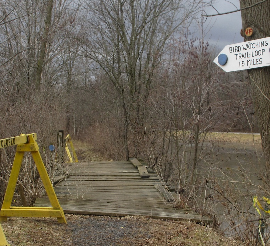
The foot bridge on the 1825 towpath trail just west of the Water Authority Access Road in the Vischer Ferry Preserve. The deck needs work so that it is safe for pedestrian, mountain bike, and light trail maintenance equipment.
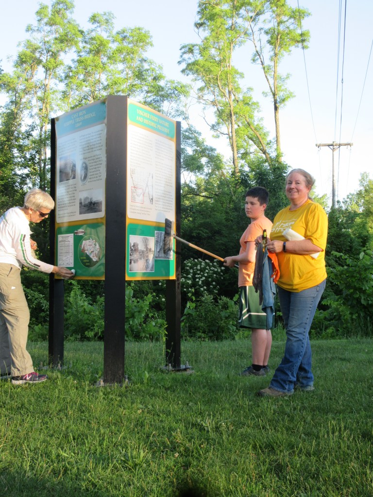
Interpretive Signs within the Vischer Ferry Preserve need to be cleaned. These are lacquered metal panels that tend to attract a grimy dark film over the years that needs to be washed and waxed with a quality automotive wax. We have done this in past years as a “flash mob” activity.
Self Guided Tour needs to be updated; narratives shortened so not to loose audience and add historic photos to bring the history of the site to life. We also need to add archived Erie Blvd narratives.
Wayfinding Signs need to be replaced. After 10 years some of the signs have faded, especially the south facing signs. This will start by inventorying the signs that need to be replaced and then working with the Town Highway Departments to install the replacements.
Duathlon planning is high on our priority list. This event highlights the recreational features of the Byway and provides a substantial amount of the organization’s revenue. We need sponsors and volunteers to pitch in to make this a success!
Writing and photography helps provide content for this blog as well as publicity and keeping our fellow volunteers energized and informed. Volunteering to “man” our booth at various functions provides an opportunity to “meet our public.”
Building a frame and installing an interpretive sign at the Mohawk Landing Park in Rexford. This will round out the interpretive signs envisioned 20 years ago when the Corridor Management Plan was prepared. The panels described our agricultural heritage and growing leisure time during the Industrial Revolution.
Baking healthy snacks for our work details, meetings, and events is always appreciated and helps keep the enthusiasm and energy flowing.
Roadside Cleanups twice a year where you live or work helps keep the Byway attractive for our visitors. Adopt a segment of roadway and take credit with a sign that recognizes your stewardship.
If you would like to help out with any one of these projects please let us know. Obviously some may have better appeal than others and you are certainly allowed to “cherry pick” the one or two that most appeal to you!
Comment: An informal poll of active members the Friends listed the above projects in order of priority.
Repair footbridge (done early April)
Cleaning interpretive signs (done April 14)
Planning Duathlon (unfortunately canceled June 9)
Building a Frame for interpretive sign (design complete Apr 28, Installation completed August 10)
Replacing Faded Wayfinding signs (inventory under way)
Up Dating the Self-Guided Tour (two sites added another one edited)
Writing and Photography (continuing)
Roadside Cleanups (unfortunately didn’t get done this year) and
Refreshments for meetings and work crews (Moved to virtual meetings).
Three write-in activities included develop public access along the Byway in new locations, partnering with other groups to do joint projects and events, and representing the Byway in the National Scenic Byway Foundation.